NO GPS, NO PROBLEM: New Interactive Chippewa Valley Bike Route Map Launches
geolocate where you are via your smartphone and map out your next ride
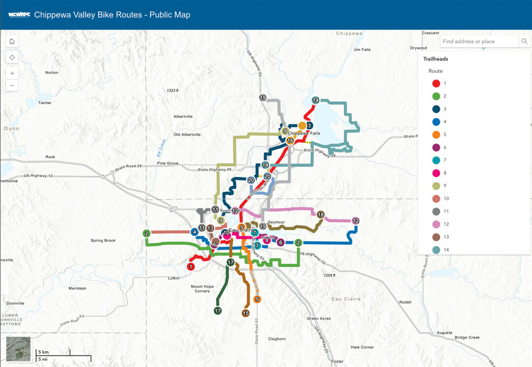
All across the Chippewa Valley, new signs have been posted along 211 miles of trails and pathways to help bikers plan routes and stay on the right course. Hundreds of signs are still going up in the area – all are slated to be up by summer 2025 – to establish specific routes for bikers to get to their destination or map out their next ride.
Bike Chippewa Valley and The Chippewa-Eau Claire Metropolitan Planning Organization (MPO) went live this past month with a new bike route website to go along with the signs and help bikers visualize the 20 posted routes (about half of the 20 routes currently have signage). This interactive map illustrates the paths and their individual lengths.
Eric Anderson, a senior planner for the West Central Wisconsin Regional Planning Commission, said the project began in 2016 and included communications with Chippewa Valley government entities – including the cities of Eau Claire, Altoona, and Chippewa Falls and the Village of Lake Hallie – as well as the private sector and tourism bureaus to coordinate the routes.
“It’s a way for locals to use a system to find routes,” Anderson said. “When people come to town and they're looking for different areas to bike, it provides them an opportunity to have designated routes to follow if they want to go to specific destinations.”
The website is set up to show the user’s location and provide a blue dot for bikers to find where they are and reorganize their trip in case they get lost or want to change routes. “Users also have the ability to click the ‘My Location’ widget to see their location within the map while using a mobile device as you travel and utilize the system of routes,” a recent media release explained.
The website is available now and is set to grow: The next step is installing QR codes on every sign to provide easier access to the map. The QR codes are currently being organized to be posted later this year.
“We want to make it as easy as we can to find the site and to find out what the system is,” Anderson said.
Check out the Chippewa Valley bike map online and keep an eye out for more signs going up in your area.

